May 12, 2026
W&L Economics Professor Co-Authors Paper in Science
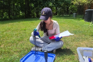
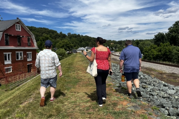 (From l-r) Byron Faidley, digital collections manager; Olivia Schweiter ’28 and Keegen Dzurko ’28 conducted fieldwork to produce a digital story map on the Maury River’s industrial and transportation history.
Washington and Lee University faculty are putting their research on the map — literally. This summer, Mackenzie Brooks, professor and digital humanities librarian, and Cal Bryan, assistant professor of economics, are both using ArcGIS (a web-based mapping software) to take an innovative approach to their research, collaborating with undergraduate students through W&L’s Summer Research Scholars (SRS) program.
Brooks is producing a digital story map that provides historical information about the Maury River in Rockbridge County, Virginia, and Bryan is investigating how aircraft have been employed in combating active wildfires. While their two projects are different, they share a common goal: to take an interdisciplinary approach to environmental study and create a resource that serves the public.
“Research is a critical part of educational coursework, but projects with a professor give deeper insight to the impact our research can have on larger issues outside of our university”
~ Rachel Collins ’27
Mapping the Maury
Brooks is working with Rockbridge Outdoors and Byron Faidley, W&L’s digital collections manager, to produce a digital story map on the Maury River’s industrial and transportation history. For Brooks, who also serves as program head of W&L’s digital culture and information (DCI) minor, this project fits right in alongside her interests in championing digital scholarship and making history more accessible.
“[This experience] is very much at the heart of digital humanities … and thinking about how the shape of the container of information is going to change the nature of what we’re doing with that information and how that knowledge gets shared and built,” Brooks said.
SRS student Keegen Dzurko ’28 is working with Brooks to create data sets and digital maps with ArcGIS to provide a resource people can use while walking or paddling along the Maury River to learn more about its development in the 19th century and the marks of various mills, canals and railroads that can still be seen along the banks. Brooks appreciates the way Dzurko, an earth and environmental geoscience major, has leaned into the interdisciplinary storytelling that the project requires as they conduct fieldwork along the river to record the various transportation features that remain and supplement their findings with research in W&L’s Special Collections and Archives.
Dzurko has also appreciated being able to apply his environmental geoscience background to the project because of how deeply intertwined the history of Rockbridge County is with its geology and hydrology.
“This project wouldn’t be possible without considering all the different angles and disciplines that it pulls on, and they all work together well to promote an overall stronger project,” he explained.
For Dzurko, a research day consists of diving into Special Collections, tracking down any historical surveys, maps, published literature or other sources that can provide information about the river’s history and the people who shaped it. He then turns to ArcGIS to find the best way to present this information digitally; he has found the tool’s StoryMaps feature to be particularly helpful in crafting a narrative where location plays a central role.
Deciding what makes it into the narrative has been a challenging part of the project but also serves as an important lesson in public history and how knowledge is disseminated. As he combs the archives, Dzurko has to decide what is important enough to include in the story map, and he is learning how these decisions can shape how information is distributed and received, which can affect how audiences interpret and share the information over time. Although Dzurko has to be discerning with what information is initially presented, one of the benefits of working with a digital tool like ArcGIS StoryMaps is that users will be able to access full digital sources online, going beyond the constraints of what information can fit in a printed page.
“This project has been a great way to explore new methods for research and helped me refine how I think about making accessible and educational communication,” Dzurko said. “These skills are incredibly useful in any field, and I hope to be able to work more in the future on similar projects that sit at this intersection of research and public communication.”
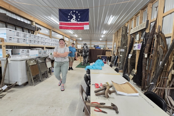 Mackenzie Brooks, professor and digital humanities librarian, and Dzurko explored artifacts that provide insight into the Maury River’s history and the people who shaped it.
Wildfire Containment
Like Brooks and Dzurko, Bryan and his team are also exploring the dynamic and public-serving properties of maps, using ArcGIS to chart the protected and unprotected regions within a wildfire after retardant has been dropped. The goal is to create a data set that can support the U.S. Forest Service’s efforts to contain wildfires, with an emphasis on economic efficiency. This is where the interdisciplinary perspectives become useful, Bryan explains.
“These students already understand the importance of being able to blend these different disciplines together,” said Bryan, referring to W&L’s liberal arts curriculum. “They get to collaborate across departments, and it’s important not just for them to get their hands on blending these different types of research, but also for me to hear the ideas informed by their academic experience.”
Rachel Collins ’27, Andrew Deppen ’28 and Sulav Sapkota ’29 are working with Bryan through the SRS program, taking the data collected from wildfires in the United States (primarily in the western states) from 2020-2023 and using ArcGIS to map the wildfires’ progressions, suppression lines and aircraft drops of retardant. The information collected and synthesized this summer supports Bryan’s larger research project, which is to determine how effective aircraft are at halting the spread of wildfire, and potentially how effective they might be at achieving other outcomes related to wildfire, such as reducing the intensity of the flames or delaying the fire’s spread.
“Once we can determine how effective these resources are and establish more tangible parameters, we can then take these estimates and turn them into a cost-effectiveness metric,” said Bryan, who also spent several seasons with the U.S. Forest Service in the Rocky Mountains, serving as a trail crew supervisor and wildland firefighter. “This metric provides a good evaluation point for considering how cost effective aircraft is to fight fire and helps determine whether it would be most effective to use aircraft or a different firefighting tactic for future wildfires.”
Collins has found GIS to be particularly suited for this project because of its capability to synthesize data efficiently, allowing her and her teammates to develop algorithms that will detect patterns in the retardant drops and fire suppression lines. A double major in earth and environmental geoscience and East Asian languages and literatures, Collins worked with ArcGIS before this summer, but typically with projects that were centered around hydrology studies. She has appreciated applying the tool in a new way that allows her to broaden her data management and analysis skills.
“ArcGIS has been a key tool, as the combination of visual and tabular data is key to working efficiently on this project,” Collins said. “Looking at the fire and the surrounding topography is necessary to identify the protected areas, and the tabular version of the drop data makes modification and file management quicker and more organized.”
The process has also allowed Collins and her teammates to gain valuable research and lab experience, which Collins considers a central element of a W&L education and “builds both our resumes and our character.”
“I am very lucky to have amassed as much undergraduate research experience as I have,” Collins said. “Research is a critical part of educational coursework, but projects with a professor give deeper insight to the impact our research can have on larger issues outside of our university, like our work with the U.S. Forest Service. ‘Research’ as a field is diverse, and having the opportunity to join or start research projects within undergraduate years allows us to investigate our strengths, weaknesses, skills and interests at an early time in our career.”

You must be logged in to post a comment.